
When NASA's Aqua satellite passed over the Northwestern Pacific Ocean on July 19, the large Tropical Storm Ampil appeared much more organized than it did the previous day.
When NASA's Aqua satellite passed over the Northwestern Pacific Ocean on July 19, the large Tropical Storm Ampil appeared much more organized than it did the previous day.
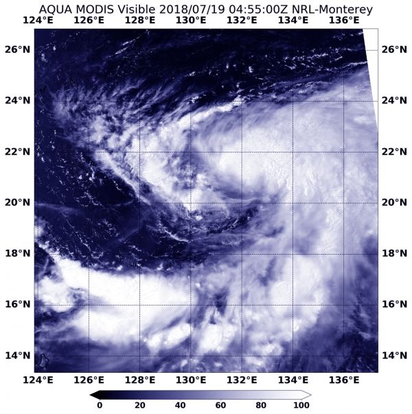
On July 19 at 12:55 a.m. EDT (0455 UTC), the MODIS or Moderate Resolution Imaging Spectroradiometer instrument aboard NASA's Aqua satellite captured a visible light image of the storm. Ampil took on the shape of a more organized tropical storm, although it was still elongated. According to the Joint Typhoon Warning Center, the elongation was about 100 nautical miles in diameter from southwest to northeast.
MODIS imagery revealed powerful thunderstorms surrounded the center of circulation and a large feeder band of thunderstorms extended from the eastern quadrant to the south. Satellite imagery shows that Ampil is about 500 miles in diameter.
Read more at NASA / Goddard Space Flight Center
Image: On July 18, the MODIS instrument aboard NASA's Aqua satellite captured a visible light image of Tropical Storm Ampil in the Northwestern Pacific Ocean that showed it was more organized. CREDITS: NASA / NRL


