
The public can now access information about active wildfires across the country using a smartphone.
The public can now access information about active wildfires across the country using a smartphone.
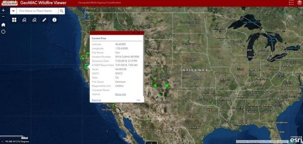
The newly designed GeoMAC, a near real-time web mapping service hosted by the U.S. Geological Survey, is now available through any web browser compatible with mobile devices.
According to the National Interagency Fire Center, 36,689 wildfires have burned 4,151,098 acres in the conterminous U.S. since January 1, 2018.*
“The newly mobile-optimized GeoMAC is easy to use on a smartphone and should be an excellent addition to the valuable information GeoMAC provides to fire coordination personnel, firefighters, the press and the public,” said Randall Schumann, Associate Director of the USGS Geosciences and Environmental Change Science Center, which manages the GeoMAC project.
Continue reading at USGS.
Image via USGS.


