
By mapping the heat escaping from below the Greenland Ice Sheet, a NASA scientist has sharpened our understanding of the dynamics that dominate and shape terrestrial planets.
By mapping the heat escaping from below the Greenland Ice Sheet, a NASA scientist has sharpened our understanding of the dynamics that dominate and shape terrestrial planets.
Dr. Yasmina M. Martos, a planetary scientist at NASA's Goddard Space Flight Center in Greenbelt, Maryland, mined publicly available magnetic field, gravity and other geologic information for clues about the amount and distribution of heat beneath the portion of the North American continent that is Greenland.
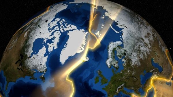
Her resulting heat map exposed a thermal track beneath Greenland that records the movement of a continent through Earth’s history.
Greenland is thought to have slowly moved over a mantle plume, a source of great heat, which left a diagonal scar of warm, dense rock below the surface as the tectonic plate shifted. Greenland moved from a more southern latitude toward the Arctic over 100 million years, a period when the supercontinent Pangaea was breaking up into the drifting continents of today. Eventually, the plume is thought to have formed Iceland above the surface of the ocean through countless volcanic eruptions — a visible trace of the plume's existence, in contrast to Greenland's hidden scar.
Read more at NASA/Goddard Space Flight Center
Image: This is a visualization of the continental plates around Greenland. (Credit: NASA's Goddard Space Flight Center)


