
NASA's Terra satellite analyzed Hurricane Hector in infrared light to find the strongest parts of the storm. Overnight from Aug. 1 to Aug. 2, Hector strengthened into a hurricane in the Eastern Pacific Ocean.
NASA's Terra satellite analyzed Hurricane Hector in infrared light to find the strongest parts of the storm. Overnight from Aug. 1 to Aug. 2, Hector strengthened into a hurricane in the Eastern Pacific Ocean.
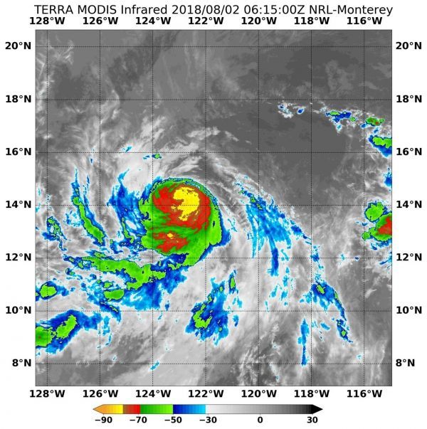
On Aug. 2 at 2:15 a.m. EDT (0615 UTC) the Moderate Resolution Imaging Spectroradiometer or MODIS instrument aboard NASA's Terra satellite analyzed Hector's cloud top temperatures in infrared light. The higher the storm, the stronger the uplift, and likely the stronger the storm. By analyzing a storm in Infrared light, scientists can tell cloud top temperatures that give clues about the location of the highest, coldest and strongest storms.
MODIS found cloud top temperatures of strongest thunderstorms were as cold as or colder than minus 80 degrees Fahrenheit (minus 62.2 Celsius) around the small eye. Cloud top temperatures that cold indicate strong storms that have the capability to create heavy rain.
Read more at NASA / Goddard Space Flight Center
Image: On Aug. 2 at 2:15 a.m. EDT (0615 UTC) NASA's Terra satellite found coldest temperatures of strongest thunderstorms (yellow) in Hurricane Hector were as cold as or colder than minus 80 degrees Fahrenheit (minus 62.2 Celsius). CREDITS: NRL / NASA


