
A new way of exploring the Mighty Mississippi and surrounding aquifers will take flight in August not by boat; rather, the sky, to identify what resources lie beneath.A new way of exploring the Mighty Mississippi and surrounding aquifers will take flight in August not by boat; rather, the sky, to identify what resources lie beneath.
A new way of exploring the Mighty Mississippi and surrounding aquifers will take flight in August not by boat; rather, the sky, to identify what resources lie beneath.A new way of exploring the Mighty Mississippi and surrounding aquifers will take flight in August not by boat; rather, the sky, to identify what resources lie beneath.
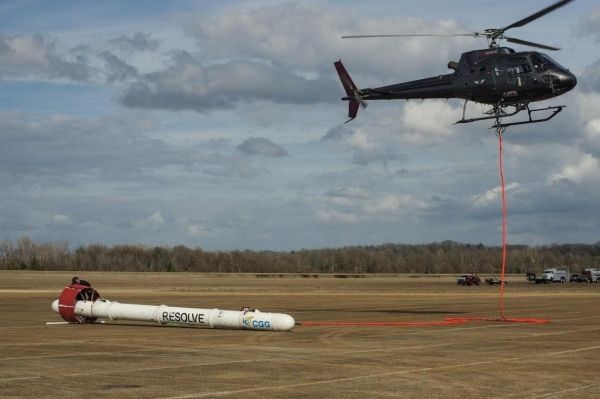
In February, 2018, the USGS began the first phase of airborne geophysical surveys in a series of high-resolution flights near Greenwood, Mississippi, to acquire large-scale airborne geophysical data in support of the Mississippi Alluvial Plain (MAP) Regional Water Availability Study. The contract was awarded to CGG, and the USGS is working in partnership with multiple state agencies to conduct the research. The geophysical instruments used in this study are able to map aquifer properties below ground, to depths of up to about 1,000 feet.
This airborne survey, which could last through 2022, will be used to map nearly 100,000 square kilometers, or 38,627 square miles, of the surficial Mississippi River Valley alluvial aquifer system, which includes portions of seven states—Illinois, Missouri, Kentucky, Tennessee, Arkansas, Mississippi and Louisiana. A multi-sensor platform featuring electromagnetic, magnetic and radiometric sensors will be deployed to map the underground aquifer system and deeper hydrogeologic setting.
Continue reading at USGS.
Image via USGS.


