
NASA's Aqua satellite passed over the Central Atlantic Ocean and looked at cloud top temperatures in Debby, revealing the storm had transitioned from subtropical to tropical.
NASA's Aqua satellite passed over the Central Atlantic Ocean and looked at cloud top temperatures in Debby, revealing the storm had transitioned from subtropical to tropical.
Subtropical Storm Debby Advisory Number 1 was issued on Aug. 7 by the National Hurricane Center, Miami, Fla. Debby formed far from land areas in the Central North Atlantic Ocean.
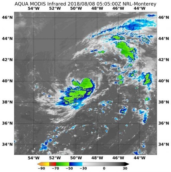
On Aug. 8 at 1:05 a.m. EDT (0605 UTC), the Moderate Resolution Imaging Spectroradiometer or MODIS instrument aboard NASA's Aqua satellite captured an infrared image of Debby. The image showed three areas of the strongest thunderstorms. They were around the center of circulation, southeastern, southwestern quadrants and in a band of thunderstorms south of the center. MODIS infrared data showed that some of those storms had cloud top temperatures as cold as minus 50 degrees Fahrenheit (minus 45.5 degrees Celsius), indicating they are high in the troposphere. Cloud tops continued to warm indicating stronger uplift in the storm, and the transition into a tropical cyclone.
Read more at NASA/Goddard Space Flight Center
Image: On Aug. 8 at 1:05 a.m. EDT (0605 UTC), the MODIS instrument aboard NASA's Terra satellite captured an infrared image of Tropical Storm Debby in the North Central Atlantic Ocean. (Credit: NASA Goddard MODIS Rapid Response Team)


