
NOAA-supported scientists have determined that this year’s Gulf of Mexico “dead zone”— an area of low oxygen that can kill fish and marine life — is approximately 2,720 square miles.
NOAA-supported scientists have determined that this year’s Gulf of Mexico “dead zone”— an area of low oxygen that can kill fish and marine life — is approximately 2,720 square miles (7,040 square kilometers), an area about the size of Delaware. This summer’s dead zone size is the fourth smallest area mapped since 1985 and is smaller than the 5,780 square miles forecast by NOAA in June.
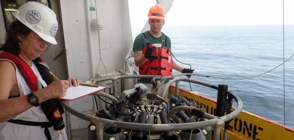
The effort to determine the size of the dead zone was led by scientists at Louisiana State University and the Louisiana Universities Marine Consortium during a research cruise from July 24 to 28 aboard the R/V Pelican.
“Persistent winds from the west and northwest in the few weeks preceding the cruise likely pushed the low oxygen water mass to the east and piled it towards the central shelf and towards Grand Isle. Additional winds and waves at the beginning of the cruise in the area to the immediate west of the Mississippi River delta to the area off Barataria Pass, likely mixed oxygen into these shallower waters and reduced the hypoxia,” said Nancy Rabalais, Ph.D., professor at LSU and LUMCON, who led the survey mission. “This resulted in an unexpectedly small dead zone, though similar conditions and smaller areas of bottom-water hypoxia were documented in 1998 and 2009.”
The annual hypoxia forecast uses nutrient runoff data from the U.S. Geological Survey in a suite of well-tested models developed by NOAA and its partners over the past decade. The models have helped validate the significant role that Mississippi River nutrient runoff plays in determining the onset and size of the dead zone during the summer, and helps set nutrient reduction targets.
Continue reading at NOAA.
Image via NOAA.


