
An infrared look by NASA's Terra satellite found powerful storms in the center of Tropical Storm Cimaron that resembled a "Picasso-like" face as they zig-zagged around the center of circulation.
An infrared look by NASA's Terra satellite found powerful storms in the center of Tropical Storm Cimaron that resembled a "Picasso-like" face as they zig-zagged around the center of circulation.
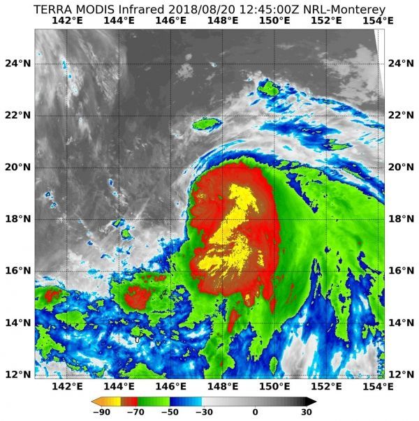
On Aug. 20 at 8:45 a.m. EDT (1245 UTC) the Moderate Resolution Imaging Spectroradiometer or MODIS instrument aboard NASA's Terra satellite analyzed Tropical Storm Cimaron's cloud top temperatures in infrared light. MODIS found cloud top temperatures of strongest thunderstorms were as cold as or colder than minus 80 degrees Fahrenheit (minus 62.2 Celsius) around the center. Cloud top temperatures that cold indicate strong storms that have the capability to create heavy rain.
The Joint Typhoon Warning Center or JTWC noted that animated enhanced infrared satellite imagery showed banding features wrapping into a partially exposed low-level circulation center.
Read more at NASA / Goddard Space Flight Center
Image: On Aug. 20 at 8:45 a.m. EDT (1245 UTC) NASA's Terra satellite found coldest temperatures of strongest thunderstorms (yellow) in Tropical Storm Cimaron were as cold as or colder than minus 80 degrees Fahrenheit (minus 62.2 Celsius) and zig-zagged around the center. CREDITS: NRL / NASA


