
NASA's Aqua satellite provided a look at water vapor in Typhoon Soulik as it passed just south of Japan.
NASA's Aqua satellite provided a look at water vapor in Typhoon Soulik as it passed just south of Japan.
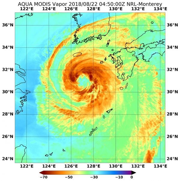
Water vapor releases latent heat as it condenses into liquid. That liquid becomes clouds and thunderstorms that make up a tropical cyclone. NASA's Aqua satellite passed over Soulik on Aug. 22 at 12:50 a.m. EDT (0450 UTC), and the Moderate Resolution Imaging Spectroradiometer or MODIS instrument aboard analyzed the water vapor content in the storm. MODIS found highest concentrations and strongest storms north of the eye, ranging from northwest to northeast of the center.
Read more at NASA / Goddard Space Flight Center
Image: On Aug. 22 at 12:50 a.m. EDT (0450 UTC), NASA's Aqua satellite analyzed water vapor In Typhoon Soulik and found strongest storms (dark green) north of the center. CREDITS: NASA / NRL


