
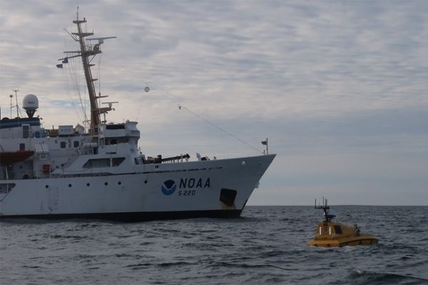
A team of engineers and students from UNH’s Center for Coastal and Ocean Mapping (CCOM) recently returned from a voyage that deployed the first autonomous (robotic) surface vessel — the Bathymetric Explorer and Navigator (BEN) — from a NOAA ship far above the Arctic Circle.
A team of engineers and students from UNH’s Center for Coastal and Ocean Mapping (CCOM) recently returned from a voyage that deployed the first autonomous (robotic) surface vessel — the Bathymetric Explorer and Navigator (BEN) — from a NOAA ship far above the Arctic Circle. Deployed from the NOAA hydrographic ship Fairweather, the vessel mapped the seafloor in an effort to improve nautical charts in areas where there is scarce data and increased vessel traffic.
The robotic boat increased the survey coverage of the ship’s efforts by as much as 25 percent during day operations alone and, if integrated into the ship’s routine production survey operations, could be operated by existing shipboard personnel.
The Fairweather spends each summer surveying the seafloor in West Coast and Alaskan waters to improve the nation’s nautical charts. In the Arctic, many of these charts are built from scant sounding data, often from measurements that are hundreds of years old, because there is no additional data. As summer shipping increases in Arctic waters, a national effort is underway to improve the charts to ensure safety, but short summers, limited good weather, remote locations and the vast amount of seafloor to survey make for a daunting task.
Continue reading at University of New Hampshire.
Image via NOAA.


