
When Hurricane Florence makes landfall on the North Carolina coastline this week, Catherine Edwards will be hoping the super-storm doesn’t veer toward her home in Savannah, Georgia. But even if Florence maintains a safe distance, Edwards will still have an intimate view of the weather: she's tracking the hurricane's path with a remote-controlled underwater ocean glider.
When Hurricane Florence makes landfall on the North Carolina coastline this week, Catherine Edwards will be hoping the super-storm doesn’t veer toward her home in Savannah, Georgia. But even if Florence maintains a safe distance, Edwards will still have an intimate view of the weather: she's tracking the hurricane's path with a remote-controlled underwater ocean glider.
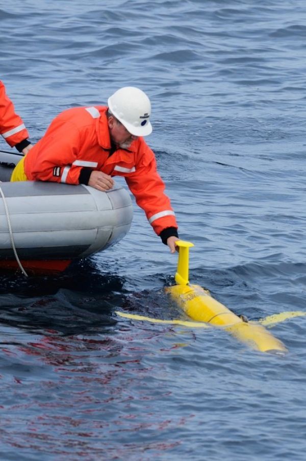
Edwards, an assistant professor of marine sciences at the Skidaway Institute of Oceanography, is one of dozens of marine scientists who are gathering data about hurricanes with a new tool: a six-foot long underwater drone, known as a Slocum glider, which carries sensors to measure ocean heat, salinity, and density.
Normally, these torpedo-like gliders travel up and down the East Coast and Caribbean mapping the ocean currents that influence short-term weather, long-term climate change, and marine life. Now, these gliders are part of the scientific armada probing Hurricane Florence for data in an effort to help forecasters understand its trajectory and strength. That armada includes at least a dozen Earth-orbiting satellites, hurricane hunter aircraft, and moored ocean buoys.
“We made a special push to get the gliders out in advance of the hurricane,” Edwards said. “One is off Cape Hatteras and will be measuring what happens in that quadrant of the storm; the other one is off the Georgia-South Carolina border and will be instrumental in measuring the southern half of the storm.”
Read more at Wired
Image: A SkIO technician recovers a glider near the shelf break off Long Bay, South Carolina. (Credit: Eric Bowles)


