
Tropical Storm Kirk formed on Saturday, Sept. 22. By Monday, Sept. 24, Kirk lacked the closed circulation that is a prerequisite for tropical cyclone status. The NOAA-20 satellite provided a visible image of the storm at its peak.
Tropical Storm Kirk formed on Saturday, Sept. 22. By Monday, Sept. 24, Kirk lacked the closed circulation that is a prerequisite for tropical cyclone status. The NOAA-20 satellite provided a visible image of the storm at its peak.
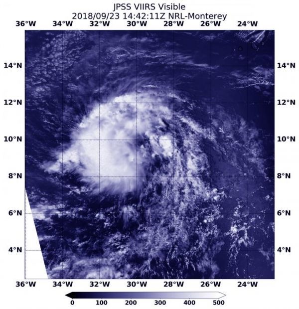
On Sept. 23, 2018 at 10:42 a.m. EDT (1442) NOAA’s JPSS-1 (NOAA-20) satellite captured this visible image of Kirk at the height of its strength when it was a tropical storm with maximum sustained winds near 40 mph (65 kph). NOAA-20 is the second in a series of five polar-orbiting satellites to monitor the Earth’s atmosphere, land and oceans. NASA builds the JPSS series of satellites and NOAA operates them.
Read more at NASA/Goddard Space Flight Center
Image: On Sept. 23, 2018 at 10:42 a.m. EDT (1442) NOAA's JPSS-1 satellite captured this visible image of the remnants of Tropical Depression Kirk. (Credit: NOAA/NRL)


