
NASA-NOAA’s Suomi NPP satellite passed over the Eastern Pacific Ocean as Tropical Storm Rosa was strengthening into that ocean basin’s tenth hurricane.
NASA-NOAA’s Suomi NPP satellite passed over the Eastern Pacific Ocean as Tropical Storm Rosa was strengthening into that ocean basin’s tenth hurricane.
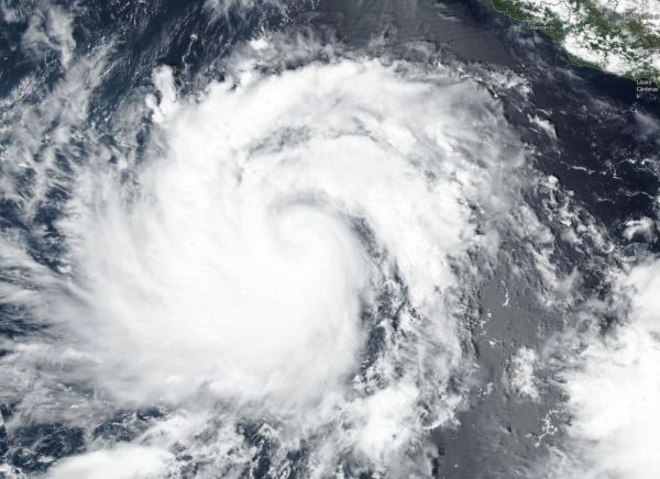
On Sept. 25, the Visible Infrared Imaging Radiometer Suite (VIIRS) instrument aboard NASA-NOAA’s Suomi NPP satellite provided a visible light image of Tropical Storm Rosa. The VIIRS image showed powerful thunderstorms around the center of circulation and thick bands of thunderstorms spiraling into the center from the northern and eastern quadrants.
Read more at NASA/Goddard Space Flight Center
Image: On Sept. 25 NASA-NOAA's Suomi NPP satellite provided a visible image of Tropical Storm Rosa as it was strengthening to become the Eastern Pacific Ocean's tenth hurricane. (Credit: NASA Worldview, Earth Observing System Data and Information System (EOSDIS))


