
Wind shear is an adversary of tropical cyclones like Tropical Storm Nadine, and it is tearing the storm apart in the Eastern Atlantic Ocean. NASA-NOAA’s Suomi NPP satellite captured an image of Nadine as wind shear was affecting it.
Wind shear is an adversary of tropical cyclones like Tropical Storm Nadine, and it is tearing the storm apart in the Eastern Atlantic Ocean. NASA-NOAA’s Suomi NPP satellite captured an image of Nadine as wind shear was affecting it.
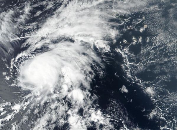
NASA-NOAA’s Suomi NPP satellite provided a visible image of Tropical Storm Nadine on Oct. 10 as it was being affected by wind shear. The image showed that clouds were being pushed northeast of the center. Satellite data shows that Nadine is strongly sheared and the low-level center of the tropical storm is now completely exposed, nearly 50 nautical miles to the southwest of the nearest deep convection (rising air that forms the thunderstorms that make up a tropical cyclone).
In general, wind shear is a measure of how the speed and direction of winds change with altitude. In order to understand how it affects a tropical cyclone or hurricane, think of a tropical cyclone as a vertical rotating cylinder. The different levels of rotating winds in the center of Tropical cyclones need to be stacked on top each other for the storm to strengthen. If there are outside winds pushing against the cylinder near the top, it affects the balance of the entire cylinder and that’s what happens when vertical wind shear pushes against a storm. It pushes the center and weakens (or wobbles) the rotation of the entire cylinder (storm).
Read more at NASA/Goddard Space Flight Center
Image: On Oct. 10, NASA-NOAA's Suomi NPP satellite provided this visible image of Tropical Storm Nadine in the far eastern Atlantic Ocean as it was being affected by wind shear that was weakening the storm. (Credit: NASA Worldview, Earth Observing System Data and Information System (EOSDIS)/ NOAA)


