
High-tide flooding—sometimes called nuisance flooding—washes into U.S. coastal communities every year, disrupting storm- and wastewater systems, damaging roads and infrastructure, and straining city budgets.
High-tide flooding—sometimes called nuisance flooding—washes into U.S. coastal communities every year, disrupting storm- and wastewater systems, damaging roads and infrastructure, and straining city budgets. Thanks to NOAA scientists, the seasonal risk of these events doesn’t have to come as a surprise. This year’s outlook predicts an above-average number of high-tide flooding days from May 2018-April 2019 for spots on both coasts. Overall, high tide flood frequencies are predicted to be 60% higher this year across U.S. coastlines compared to the year 2000.
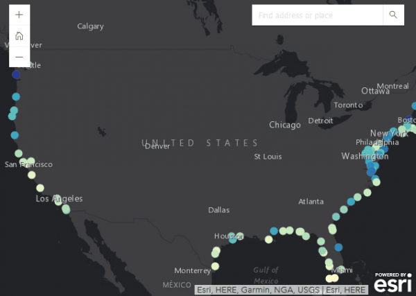
This interactive map shows the predicted number of high tide flooding days for almost 100 locations, represented by colored dots, along the East and West Coast of the United States, the Caribbean, and Pacific Ocean. Blue colors represent a higher number of predicted flood days while green-yellow colors represent a lesser amount. At each location, you can also click for a pop-up window that shows the range of uncertainty in the 2018 forecast, the typical number of high-tide flood days observed every year (around the year 2000), and the record number through 2017.
Continue reading at NOAA - Climate.gov.
Image via NOAA - Climate.gov.


