
Ground penetrating radar isn’t something from the latest sci-fi movie. It’s actually a tool used by soil scientists to measure the amount of moisture in soil quickly and easily.
Ground penetrating radar isn’t something from the latest sci-fi movie. It’s actually a tool used by soil scientists to measure the amount of moisture in soil quickly and easily.
As with most technologies, it is getting better and new ways to use it are being tested. Jonathan Algeo, a graduate student at Rutgers University, has spent his studies making ground penetrating radar better for different uses, such as measuring soil moisture.
“It’s a very common tool in research, agriculture, engineering, and the military for looking at buried objects and measuring water content,” Algeo explains. “One of its main benefits is that it is very fast. One example is a tool with a wheel that allows the radar to take measurements as you drag it along the ground. In this way, you can very quickly take measurements across a large field or a line that’s miles in length. Radar can be used quickly over a large area to answer many different questions.”
The technology can be used to find underground tunnels, bedrock, or cracks of metal in the supports of a bridge. In terms of soil, the questions can vary. How much water is near the surface? How does it vary throughout a field site? The near-surface water content can affect climate, so it’s important for computer-based climate models as well.
Read more at American Society of Agronomy
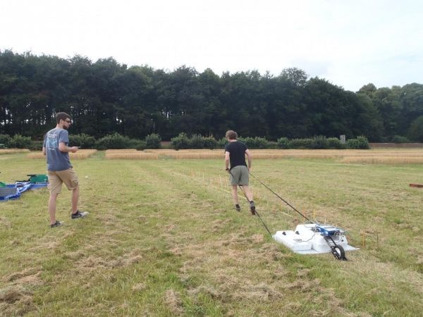
Image: Algeo stands on the left with a tablet while his advisor, Lee Slater, drags ground penetrating radar equipment over the soil's surface. (Credit: Chris Watts, Rothamsted Research)


