
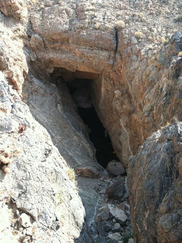
Beneath the Amargosa desert of the southwest United States lies a hidden gem for climate research. The Devils Hole cave system, named after its bottomless depths, provides a window into the vast desert aquifer below. The cave system is home to a peculiar type of calcite deposit. As groundwater slowly passes through the cave, calcite precipitates layer by layer on the rock walls. "These thin layers have been accumulating on the walls for nearly one million years," explains Kathleen Wendt from the Quaternary Research Group in the Department of Geology at the University of Innsbruck. "The height of ancient deposits in Devils Hole cave tell us how high the water table was in the past."
Beneath the Amargosa desert of the southwest United States lies a hidden gem for climate research. The Devils Hole cave system, named after its bottomless depths, provides a window into the vast desert aquifer below. The cave system is home to a peculiar type of calcite deposit. As groundwater slowly passes through the cave, calcite precipitates layer by layer on the rock walls. "These thin layers have been accumulating on the walls for nearly one million years," explains Kathleen Wendt from the Quaternary Research Group in the Department of Geology at the University of Innsbruck. "The height of ancient deposits in Devils Hole cave tell us how high the water table was in the past."
Together with her colleagues, the geologist has conducted research in the cave for several years (see report: https://www.uibk.ac.at/newsroom/dossiers/devilshole/). In the current study, the Innsbruck team used special drilling equipment to collect calcite deposits from several points above and below the current water table. The ages of the deposits were then determined using the thorium-uranium method. The results have now been published in the prestigious journal "Science Advances". "This study reveals how the height of the water table has changed over the last 350,000 years. We were surprised to discover repeated swings as high as ten meters above today’s levels," explains Wendt.
Follow the water
Rises and falls in the local water table provide important clues to how rainfall patterns in the southwest United States have changed. Most of the rainfall that recharges the desert aquifer comes from winter storms that move east along the Pacific storm track. The position and intensity of these winter storms depend on many factors, including surface ocean temperatures and the strength of pressure systems in the eastern Pacific. Whenever these factors changed dramatically in the past, such as during an ice age, the position of the Pacific storm track shifted in latitude. "Shifts in the Pacific storm track influenced the amount of rainfall reaching the southwest United States, resulting in pronounced changes in the Devils Hole water table height,” says Kathleen Wendt. "The past has shown us that this ‘water supplier’ is incredibly sensitive to global climate changes."
Read more at University of Innsbruck
Photo Credit: zygplater0 via Pixabay


