
Tropical Cyclone Gaja continued to track toward a landfall in southeastern India when NASA-NOAA’s Suomi NPP satellite flew over the Bay of Bengal and provided a visible image of the storm.
Tropical Cyclone Gaja continued to track toward a landfall in southeastern India when NASA-NOAA’s Suomi NPP satellite flew over the Bay of Bengal and provided a visible image of the storm.
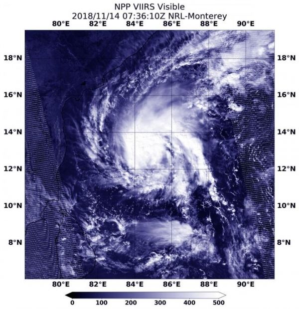
Suomi NPP passed over Gaja on Nov. 14 at 2:36 a.m. EDT (0736 UTC) and the VIIRS instrument provided a visible image. The VIIRS image showed Gaja appeared more organized than the previous day as powerful thunderstorms circled the center. A thick band of thunderstorms wrapped into the low level center from the eastern quadrant.
At 4 a.m. EDT (0900 UTC) Tropical Cyclone Gaja was located near 12.6 degrees north latitude and 84.5 degrees east longitude. That’s about 623 nautical miles south-southwest of Calcutta, India. Gaja is moving to the west-southwest and has maximum sustained winds near 45 knots (52 mph/83 kph).
Read more at NASA/Goddard Space Flight Center
Image: NASA-NOAA's Suomi NPP satellite passed over the Northern Indian Ocean and captured a visible image of Tropical Cyclone Gaja approaching the southeastern coast of India at 2:36 a.m. EDT (0736 UTC) on Nov. 14, 2018. (Credit: NASA/NOAA/NRL)


