
Caught in the act of landfall, Tropical Cyclone Gaja was seen by NASA’s Aqua satellite as it passed overhead and collected temperature information.
Caught in the act of landfall, Tropical Cyclone Gaja was seen by NASA’s Aqua satellite as it passed overhead and collected temperature information.
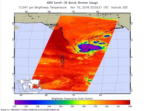
The Atmospheric Infrared Sounder or AIRS instrument aboard NASA’s Aqua satellite passed over Tropical Cyclone Gaja on Nov. 15 at 3:29 p.m. EDT (2029 UTC) and analyzed the storm in infrared light. Infrared light provides temperature data and that’s important when trying to understand how strong storms can be. The higher the cloud tops, the colder and the stronger they are.
Read more at NASA / Goddard Space Flight Center
Image: NASA’s Aqua satellite provided an infrared picture of Tropical Cyclone Gaja’s cloud top temperatures from Nov. 15 at 3:29 p.m. EDT (2029 UTC). Gaja’s center was making landfall along the coast of southeastern India. Coldest clouds tops and strongest storms appear in purple.
CREDIT: NASA JPL, Heidar Thrastarson


