
Tropical Storm Man-Yi continued to strengthen in the Northwestern Pacific Ocean as NASA-NOAA’s Suomi NPP satellite provided a visible image of the storm.
Tropical Storm Man-Yi continued to strengthen in the Northwestern Pacific Ocean as NASA-NOAA’s Suomi NPP satellite provided a visible image of the storm. Warnings are in effect through the Federated States of Micronesia at the storm continues to affect the region.
The National Weather Service (NWS) in Tiyan, Guam noted several watches and warnings in effect. A Tropical Storm Watch remains in effect for Fais and Ulithi in Yap State. A Typhoon Watch remains in effect for Faraulep in Yap State. A Tropical Storm Warning remains in effect for Satawal and Faraulep in Yap State…and for Guam and Rota in the Mariana Islands.
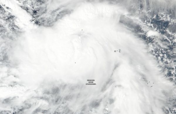
The Suomi NPP satellite passed over Man-yi on Nov. 21 and the VIIRS instrument provided a visible image. The VIIRS image showed Man-yi was a large and strong tropical storm over the Federated States of Micronesia. Tropical storm force winds extend outward from the center up to 115 miles making the storm about 230 miles in diameter.
Read more at NASA/Goddard Space Flight Center
Image: NASA-NOAA's Suomi NPP satellite passed over the Northwestern Pacific Ocean and captured a visible image of Tropical Storm Man-Yi on Nov. 21, 2018. (Credit: NASA Worldview, Earth Observing System Data and Information System (EOSDIS))


