
NASA’s Aqua satellite passed over the Northwestern Indian Ocean and captured a visible image of Tropical Depression Phethai after it made landfall in southeastern India.
NASA’s Aqua satellite passed over the Northwestern Indian Ocean and captured a visible image of Tropical Depression Phethai after it made landfall in southeastern India.
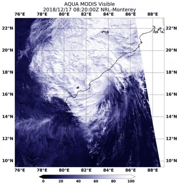
Phethai developed on Dec. 15 as tropical cyclone 08B, about 450 miles south-southeast of Visakhapatnam, India. Phethai made landfall early on Dec. 17 south of the city of Visakhapatnam, in the Indian state of Andhra Pradesh, on the Bay of Bengal.
On Dec. 17 at 3:20 a.m. EST (0820 UTC) the MODIS instrument aboard NASA’s Aqua satellite looked at Tropical Depression Phethai after it made landfall south of Visakhapatnam. Satellite imagery showed that the bulk of clouds and showers were north and east of the center of circulation indicating that wind shear was affecting the storm.
Read more at NASA/Goddard Space Flight Center
Image: On Dec. 17 at 3:20 a.m. EST (0820 UTC) the MODIS instrument aboard NASA's Aqua satellite looked at Tropical Depression Phethai after it made landfall south of Visakhapatnam in southeastern India. (Credit: NASA/NRL)


