
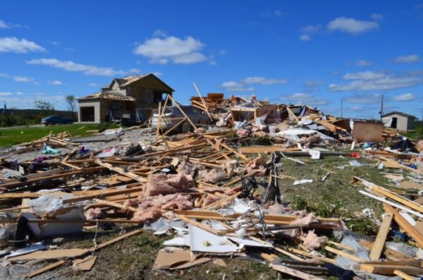
A Western-led project to discover and decode tornadoes in remote Northern Ontario has spun into a nationwide mission to identify every Canadian tornado in 2019
A Western-led project to discover and decode tornadoes in remote Northern Ontario has spun into a nationwide mission to identify every Canadian tornado in 2019. By developing this deeper database, the Northern Tornadoes Project looks to improve early detection, mitigate against damage to people and property and model for the future implications of climate change.
“The goal is to capture everything nationally – to find, assess, store data and learn from each event,” explained Engineering professor Greg Kopp, who serves as project lead. “It’s a big goal and it’s a big country.”
A collaboration between Western Engineering and the Meteorological Research Division of Environment and Climate Change Canada, the Northern Tornadoes Project uses satellites, surveillance planes, drones and on-the-ground observation to capture the events and their extent. This high-resolution data offer a level of detail down to individual trees uprooted and their direction of fall, as well as where grasslands have been scarred.
About 60 tornadoes are identified and verified in Canada each year. However, Environment Canada’s modelling of lightning density data suggests the actual number of tornadoes is almost four times that number: about 230 per year. Many of those take place in areas where forest density and remote locale make traditional ground surveys impossible, or in grasslands where damage footprints are more difficult to detect.
Continue reading at Western University.
Image via Western University.


