
As the solar industry has grown, so have some of its inefficiencies.
As the solar industry has grown, so have some of its inefficiencies. Smart entrepreneurs see those inefficiencies as business opportunities and try to create solutions around them. Such is the nature of a maturing industry.
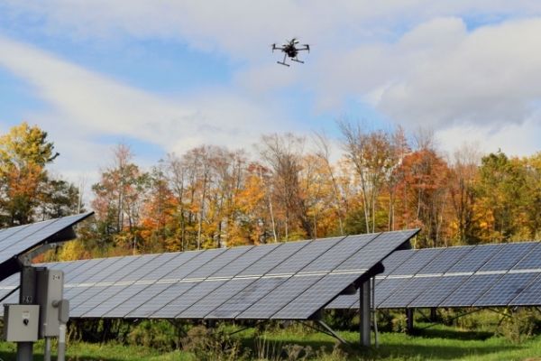
One of the biggest complications emerging from the industry’s breakneck growth is the maintenance of solar farms. Historically, technicians have run electrical tests on random sections of solar cells in order to identify problems. In recent years, the use of drones equipped with thermal cameras has improved the speed of data collection, but now technicians are being asked to interpret a never-ending flow of unstructured data.
That’s where Raptor Maps comes in. The company’s software analyzes imagery from drones and diagnoses problems down to the level of individual cells. The system can also estimate the costs associated with each problem it finds, allowing technicians to prioritize their work and owners to decide what’s worth fixing.
Read more at Massachusetts Institute of Technology
Image: As drones increasingly take on the job of inspecting growing solar farms, Raptor Maps' software makes sense of the data they collect. Image courtesy of Raptor Maps


