
Tropical Cyclone 12S has developed east of the African island nation of Madagascar.
Tropical Cyclone 12S has developed east of the African island nation of Madagascar. NASA-NOAA’s Suomi NPP satellite passed over the Southern Indian Ocean and captured a visible image of the newly formed storm that has triggered a warning for Rodrigues, an outer island of the Republic of Mauritius.
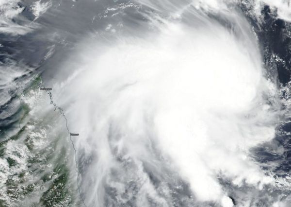
On Feb. 5, 2019, the Visible Infrared Imaging Radiometer Suite (VIIRS) instrument aboard NASA-NOAA’s Suomi NPP satellite captured visible image of Tropical Cyclone 12S. VIIRS imagery showed powerful thunderstorms wrapping into the low-level center from a large, thick band of thunderstorms spiraling in from the southern quadrant of the storm. Outer clouds from the western quadrant were just brushing the northeastern coast of Madagascar.
Read more at NASA / Goddard Space Flight Center
Image: On Feb. 5, 2019, the VIIRS instrument aboard NASA-NOAA’s Suomi NPP satellite captured a visible image of Tropical Cyclone 12S, located northeast of Madagascar, in the Southern Indian Ocean. Credit: NASA Worldview, Earth Observing System Data and Information System (EOSDIS) https://go.nasa.gov/2HRTDhi


