
Visible imagery from NASA’s Aqua satellite revealed the effects of wind shear on Tropical Cyclone Gelena in the Southern Indian Ocean. The storm weakened to a tropical storm.
Visible imagery from NASA’s Aqua satellite revealed the effects of wind shear on Tropical Cyclone Gelena in the Southern Indian Ocean. The storm weakened to a tropical storm.
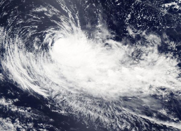
On Feb. 11, 2019, the Moderate Resolution Imaging Spectroradiometer or MODIS instrument aboard NASA’s Aqua satellite captured a visible image of Tropical Cyclone Gelena. Westerly wind shear pushed the bulk of clouds and storms east of the center. Wind shear is a measure of how the speed and direction of winds change with altitude.
Read more at NASA / Goddard Space Flight Center
Image: On Feb. 11, 2019, the MODIS instrument aboard NASA’s Aqua satellite captured a visible light image of Tropical Cyclone Gelena in the Southern Indian Ocean. Wind shear pushed the bulk of clouds and storms east of the center. CREDIT: NASA Worldview, Earth Observing System Data and Information System (EOSDIS)


