
NASA’s Aqua satellite passed over the Southern Pacific Ocean and captured a visible image of Tropical Cyclone Oma.
NASA’s Aqua satellite passed over the Southern Pacific Ocean and captured a visible image of Tropical Cyclone Oma. Oma formed northwest of Vanuatu.
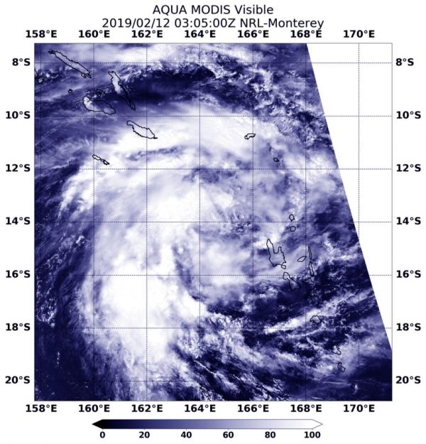
On Feb. 12 at 0305 UTC (Feb 11 at 10:05 p.m. EDT) the Moderate Resolution Imaging Spectroradiometer or MODIS instrument aboard NASA’s Aqua satellite provided a visible image of Tropical Cyclone Oma. Satellite imagery showed Oma’s center between the Solomon Islands to the northwest and Vanuatu to the southeast. The bulk of Oma’s clouds were west of the center of circulation.
At 10 a.m. EDT (1500 UTC) the center of Oma was located near latitude 13.8 degrees south and longitude 165.6 degrees east. That’s about 289 nautical miles northwest of Port Vila, Vanuatu. Oma was moving to the east. Maximum sustained winds were near 45 knots (52 mph/83 kph) and Oma is forecast to strengthen slightly over the next two days before weakening.
Read more at NASA / Goddard Space Flight Center
Image: On Feb. 12 at 0305 UTC (Feb 11 at 10:05 p.m. EDT) the MODIS instrument aboard NASA’s Aqua satellite captured a visible image of newly formed Tropical Cyclone Oma in the Southern Pacific Ocean. Oma was located northwest of Vanuatu. CREDIT: NASA / NRL


