
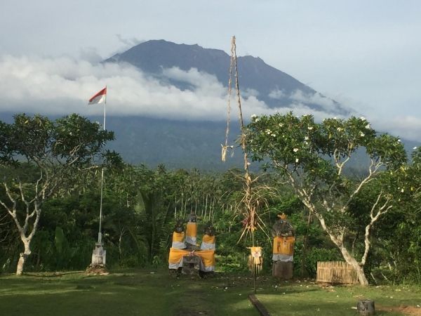
A team of scientists, led by the University of Bristol, has used satellite technology provided by the European Space Agency (ESA) to uncover why the Agung volcano in Bali erupted in November 2017 after 50 years of dormancy.
A team of scientists, led by the University of Bristol, has used satellite technology provided by the European Space Agency (ESA) to uncover why the Agung volcano in Bali erupted in November 2017 after 50 years of dormancy.
Their findings, published today in the journal Nature Communications, could have important implications for forecasting future eruptions in the area.
Two months prior to the eruption, there was a sudden increase in the number of small earthquakes occurring around the volcano, triggering the evacuation of 100,000 people.
The previous eruption of Agung in 1963 killed nearly 2,000 people and was followed by a small eruption at its neighboring volcano, Batur.
Read more at University of Bristol
Image: View of Mount Agung on Nov. 10, 2017, from the Rendang Volcano Observatory, operated by CVGHM. (Credit: Jake Lowenstern, US Geological Survey)


