
Tropical cyclones can become post-tropical before they dissipate, meaning they can become sub-tropical, extra-tropical or a remnant low pressure area.
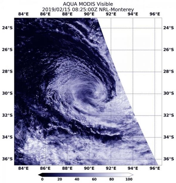
Tropical cyclones can become post-tropical before they dissipate, meaning they can become sub-tropical, extra-tropical or a remnant low pressure area. As Tropical Cyclone Gelena transitioned into a subtropical storm, NASA’s Aqua satellite provided a visible image of the storm.
On Feb 15 at 10 p.m. EDT (Feb. 16 at 0300 UTC), the Joint Typhoon Warning Center or JTWC noted that Gelena had already become subtropical. JTWC issued their final warning on Gelena. At that time, the storm had maximum sustained winds near 40 knots (46 mph/74 kph). It was centered near 29.8 degrees south latitude and 89.3 degrees east longitude. That’s 1,426 nautical miles east-southeast of Learmonth, Australia. Gelena was moving east-southeast.
What is a Post-tropical Storm?
A Post-Tropical Storm is a generic term for a former tropical cyclone that no longer possesses sufficient tropical characteristics to be considered a tropical cyclone. Former tropical cyclones that have become fully extratropical, subtropical, or remnant lows, are three classes of post-tropical cyclones. In any case, they no longer possesses sufficient tropical characteristics to be considered a tropical cyclone. However, post-tropical cyclones can continue carrying heavy rains and high winds.
Read more at NASA/Goddard Space Flight Center
Image: On Feb 15, 2019 at 10 p.m. EDT (Feb. 16, 2019 at 0300 UTC), the MODIS instrument aboard NASA's Aqua satellite provided a visible image of Gelena that showed the storm had transitioned into a post-tropical cyclone. (Credit: NASA/NRL)


