
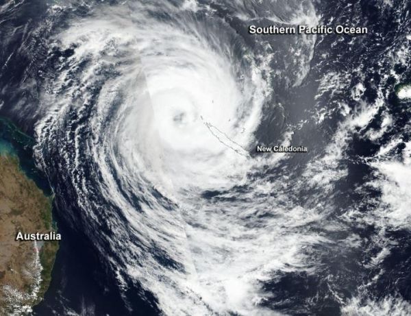
Tropical Cyclone Oma appeared well-organized on satellite imagery as it moved through the Southern Pacific Ocean, just northwest of New Caledonia.
Tropical Cyclone Oma appeared well-organized on satellite imagery as it moved through the Southern Pacific Ocean, just northwest of New Caledonia.
On February 19, New Caledonia posted a tropical cyclone alert level 2 for the communities of Belep, Hienghene, Kaala-Gomen, Koumac, Ouegoa, Ouebo and Poum. New Caledonia is a French territory that consists of dozens of islands in the South Pacific Ocean. It ls located about 750 miles (1,210 km) east of Australia.
On Feb.19, the Visible Infrared Imaging Radiometer Suite (VIIRS) instrument aboard NASA-NOAA’s Suomi NPP satellite provided a visible image of Tropical Cyclone Oma that revealed an eye surrounded by powerful thunderstorms. Oma’s southeastern quadrant covered New Caledonia. The northern tip of the island was close to Oma’s eyewall.
Read more at NASA/Goddard Space Flight Center
Image: On Feb. 19, 2019, the VIIRS instrument aboard NASA-NOAA's Suomi NPP satellite captured a visible image of Tropical Cyclone Oma near New Caledonia in the Southern Pacific Ocean. (Credit: NASA Worldview, Earth Observing System Data and Information System (EOSDIS))


