
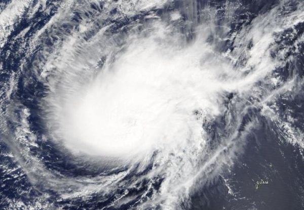
Visible imagery from NASA’s Terra satellite showed that Typhoon Wutip has become more elongated as a result of wind shear.
Visible imagery from NASA’s Terra satellite showed that Typhoon Wutip has become more elongated as a result of wind shear.
On February 27, 2019 the Moderate Resolution Imaging Spectroradiometer or MODIS instrument aboard NASA’s Terra satellite provided a visible image of Typhoon Wutip in the Northwestern Pacific Ocean. The image showed Wutip no longer has an eye and the storm has elongated from southwest to northeast.
The Joint Typhoon Warning Center noted that “Animated enhanced infrared satellite imagery shows that deep convection located around the low level circulation center has rapidly decreased.”
Read more at NASA/Goddard Space Flight Center
Image: On Feb. 27, 2019, the MODIS instrument aboard NASA's Terra satellite provided a visible image of Typhoon Wutip. (Credit: NASA Worldview, Earth Observing System Data and Information System (EOSDIS))


