
At the southern tip of the sprawling Hanford Site, the soil beneath the 300 Area contains residual uranium from a handful of now-removed settling ponds and trenches that stored liquid waste from the processing of spent nuclear fuel rods.
At the southern tip of the sprawling Hanford Site, the soil beneath the 300 Area contains residual uranium from a handful of now-removed settling ponds and trenches that stored liquid waste from the processing of spent nuclear fuel rods. Located about a quarter-mile west of the Columbia River shoreline, underground uranium concentrations remain high after years of plutonium production.
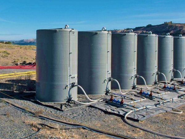
The Department of Energy Richland Operations and its site contractor CH2M HILL Plateau Remediation Company (CHPRC) recently finished injecting an approved polyphosphate solution into the ground that will bind with uranium through a process called sequestration, preventing the uranium from reaching the groundwater and Columbia River.
PNNL researchers worked with CHPRC to successfully implement a state-of-the-art approach for monitoring the delivery of the polyphosphate remediation action. The approach used PNNL’s Real-time Four-Dimensional Subsurface Imaging Software, or E4D, to image the vertical and lateral movement of the polyphosphate solution.
Read more at Pacific Northwest National Laboratory
Image: Surrounded by storage tanks and injection hoses, PNNL's E4D subsurface imaging technology monitors the delivery of a phosphate solution for binding contaminants in the soil at the Hanford Site's 300 Area near the Columbia River. CREDIT: Andrea Starr | Pacific Northwest National Laboratory


