
A new report and map published by the U.S. Geological Survey provides critical insight to electric power grid operators across the northeastern United States in the event of a once-per-century magnetic superstorm.
A new report and map published by the U.S. Geological Survey provides critical insight to electric power grid operators across the northeastern United States in the event of a once-per-century magnetic superstorm.
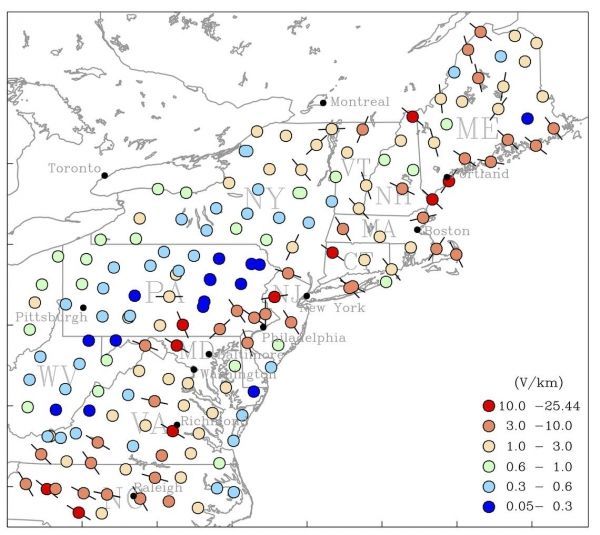
Major metropolitan areas along the I-95 corridor – including Boston, New York, Philadelphia, Baltimore, and Washington, DC – will benefit from the report’s geoelectrical hazard assessment, published in the journal Space Weather.
“These new maps will allow states and utilities to better anticipate the threat and response to future magnetic storms across the northeast,” said Jim Reilly, director of the USGS. “They will prove useful for planning for future power-grid installations and will help utility companies develop strategies to mitigate blackouts and power system damage.”
Continue reading at USGS.
Image via USGS.


