
Tropical Cyclone Haleh continued to move in a southerly direction in the Southern Indian Ocean when NASA-NOAA’s Suomi NPP satellite passed overhead.
Tropical Cyclone Haleh continued to move in a southerly direction in the Southern Indian Ocean when NASA-NOAA’s Suomi NPP satellite passed overhead.
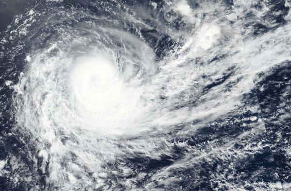
Suomi NPP passed over Haleh on March 6 and the Visible Infrared Imaging Radiometer Suite (VIIRS) instrument provided a visible image of the storm. The VIIRS image showed a large area of thunderstorms wrapping into the center and the storm appeared to be elongating toward the southeast. The elongation of the storm is a result of outside winds, or moderate to strong vertical wind shear, and is indicative of weakening.
Read more at NASA / Goddard Space Flight Center
Image: NASA-NOAA’s Suomi NPP satellite passed over the Southern Indian Ocean and captured a visible image of Tropical Cyclone Haleh on March 6. CREDIT: NASA Worldview, Earth Observing System Data and Information System (EOSDIS).


