
NASA’s Terra satellite captured an infrared image of Tropical Cyclone Idai approaching the coast of Mozambique.
NASA’s Terra satellite captured an infrared image of Tropical Cyclone Idai approaching the coast of Mozambique. The infrared data provided cloud top temperatures that indicated powerful thunderstorms circled Idai’s center.
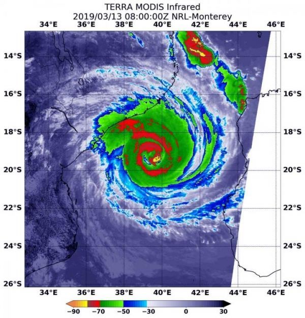
At 4 a.m. EDT (0800 UTC) on March 13 the Moderate Resolution Imaging Spectroradiometer or MODIS instrument that flies aboard NASA’s Terra satellite gathered infrared data on Idai. Infrared data provides temperature information. Strongest thunderstorms circled Idai’s center and contained cloud top temperatures as cold as minus 70 degrees Fahrenheit (minus 56.6 Celsius). NASA research has shown that cloud tops with temperatures that cold were high in the troposphere and have the ability to generate heavy rain.
MODIS infrared imagery also indicated Idai’s eye is about 20 nautical miles wide in diameter, although it was covered by high clouds.
Read more at NASA/Goddard Space Flight Center
Image: At 4 a.m. EDT (0800 UTC) on Oct. 3, 2018 the MODIS instrument that flies aboard NASA's Terra satellite gathered infrared data on Tropical Cyclone Idai. Strongest thunderstorms circled the center where cloud top temperatures were as cold as minus 70 degrees Fahrenheit (minus 56.6 Celsius) and appeared in red. (Credit: NASA/NRL)


