
Tropical Cyclone Savannah weakened and “lost” its eye as high clouds filtered over it.
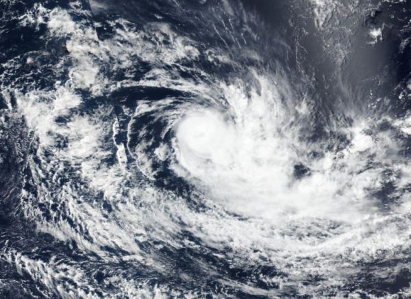
Tropical Cyclone Savannah weakened and “lost” its eye as high clouds filtered over it. NASA-NOAA’s Suomi NPP satellite passed over the Southern Indian Ocean and captured a visible image of the tropical storm that revealed high clouds had moved over its eye.
Wind shear weakened Tropical Storm Savannah and satellite imagery showed that it had become slightly elongated with clouds pushing southeast of the center. In general, wind shear is a measure of how the speed and direction of winds change.
On March 18, the Visible Infrared Imaging Radiometer Suite (VIIRS) instrument aboard the Suomi NPP satellite showed that Savannah still had a defined center, although the storm appeared somewhat elongated to the southeast, as a result of northwesterly winds. Visible imagery showed bands of thunderstorms were wrapping around the center, but the eye disappeared.
Read more at NASA / Goddard Space Flight Center
Image: On March 18, 2019, the VIIRS instrument aboard NASA-NOAA’s Suomi NPP satellite captured a visible image of Tropical Cyclone Savannah that showed its eye had become cloud-filled. Credit: NASA Worldview, Earth Observing System Data and Information System (EOSDIS)


