
A team of Arizona State University scientists has been using the latest space technology, combined with ground measurements, to assess the health of one of the nation’s most important sources of underground water, a large aquifer system located in California’s San Joaquin Valley.
A team of Arizona State University scientists has been using the latest space technology, combined with ground measurements, to assess the health of one of the nation’s most important sources of underground water, a large aquifer system located in California’s San Joaquin Valley.
The team, comprised of School of Earth and Space Exploration researchers Chandrakanta Ojha, Susanna Werth and Manoochehr Shirzaei, focused on the San Joaquin Valley’s most recent drought period, from 2012 to 2015, measuring both groundwater loss and aquifer storage loss. The results of their findings have been recently published in the Journal of Geophysical Research.
With the hope of providing water resource managers with better tools to help keep aquifers healthy, the research team is developing new observation techniques to monitor groundwater and storage capacity of this important California aquifer.
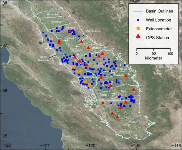
They are using a unique combination of data from the NASA GRACE satellites, the Global Navigation Satellite System (GNSS), Interferometric Synthetic Aperture Radar (InSAR) from the European Space Agency’s Sentinel 1 satellite, extensometers and ground level records.
Read more at Arizona State University
Image: Area of study in California's San Joaquin Valley highlighting the well, extensometer, and GNSS station locations that were used to collect data for this study. (Credit: ASU)


