
Tropical Cyclone Trevor appeared to have a cloud-filled eye in visible imagery from NASA-NOAA’s Suomi NPP satellite.
Tropical Cyclone Trevor appeared to have a cloud-filled eye in visible imagery from NASA-NOAA’s Suomi NPP satellite.
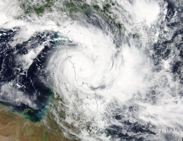
On March 19, 2019 the Visible Infrared Imaging Radiometer Suite (VIIRS) instrument aboard NASA-NOAA’s Suomi NPP satellite captured visible image of Tropical Cyclone Trevor as it continued moving west through the Coral Sea, Southern Pacific Ocean, and toward a landfall in Queensland, Australia’s Cape York Peninsula. VIIRS imagery showed powerful thunderstorms wrapping into the low-level center. At the time of the image, Trevor’s western quadrant was already over the Peninsula, and the eye appeared covered by high clouds.
After the Suomi NPP image, Trevor crossed the coast in the evening (local time) and remains slow moving just south of Lockhart River.
Read more at NASA / Goddard Space Flight Center
Image: On March 19 the VIIRS instrument aboard NASA-NOAA’s Suomi NPP satellite captured a visible image of Tropical Cyclone Trevor in the Southern Pacific Ocean as it was approaching the Cape York Peninsula of Queensland, Australia. CREDIT: NASA Worldview, Earth Observing System Data and Information System (EOSDIS)


