
Tropical Cyclone Wallace was dissipating in the Southern Indian Ocean when NASA-NOAA’s Suomi NPP satellite passed overhead.
Tropical Cyclone Wallace was dissipating in the Southern Indian Ocean when NASA-NOAA’s Suomi NPP satellite passed overhead. Wallace was located off the northwestern coast of Western Australia.
The Australian Bureau of Meteorology or ABM noted that a Strong Wind Warning was in effect for the Esperance Coast and Eucla Coast on April 10 as Wallace continued weakening far off the coast of Western Australia.
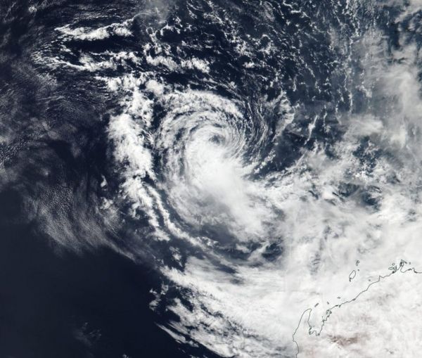
NASA-NOAA’s Suomi NPP satellite passed over Wallace on April 10 and the Visible Infrared Imaging Radiometer Suite (VIIRS) instrument provided a visible image of the storm. The VIIRS image showed wind shear has pushed the bulk of the system’s clouds southeast of the center and was tearing the storm apart.
Read more at NASA / Goddard Space Flight Center
Image: NASA-NOAA’s Suomi NPP satellite passed over the Southern Indian Ocean and captured a visible image of Tropical Cyclone Wallace on April 10 as it continued to dissipate off the coast of Western Australia. CREDIT: NASA Worldview, Earth Observing System Data and Information System (EOSDIS).


