
If you live near the Great Lakes and have to spend any significant time on the road, you’re forgiven if you get a little edgy whenever the forecast calls for lake-effect snow.
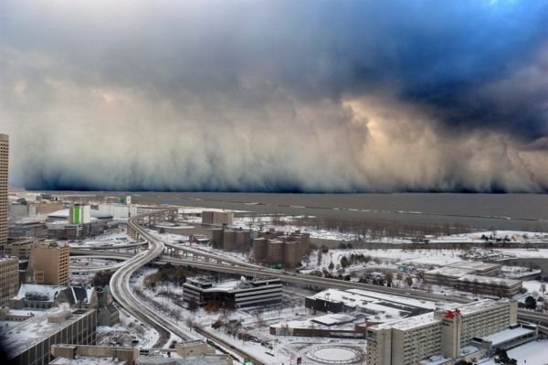
If you live near the Great Lakes and have to spend any significant time on the road, you’re forgiven if you get a little edgy whenever the forecast calls for lake-effect snow. Lake-effect snowfall is one of the most hazardous weather events in the Great Lakes region, causing prodigious dumps in a short time, often in narrow bands. Knowing where and when the snow will fall can mean the difference between avoiding a challenging drive and getting stuck in a nightmare.
To make matters worse, forecasting the timing and amount of snow is extremely challenging.
“Lake-effect snow squalls are very sensitive to the temperature and amount of ice on the underlying lake surface,” said National Weather Service meteorologist Greg Mann, the Science Operations Officer for the Detroit Weather Forecast Office. “Higher surface temperatures will support stronger, more dominant snow bands. Unfortunately, observations over the water are pretty much nonexistent during much of lake-effect season, which hampers the ability of our models to capture important features of the snow squalls. Forecasters have to turn to old rules of thumb and proxies to piece it all together, so you end up with a blurrier forecast.”
Ongoing NOAA research promises to change that.
Continue reading at NOAA.
Image via NOAA.


