
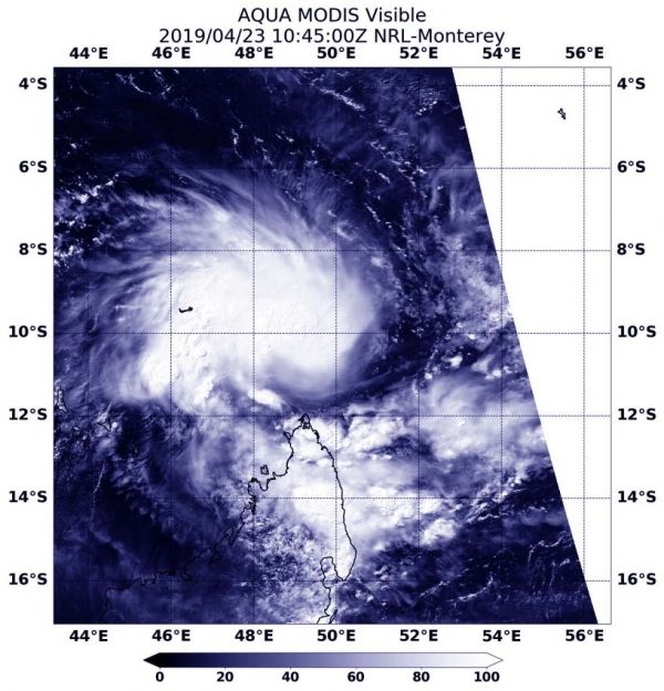
Visible satellite imagery from NASA’s Aqua satellite revealed the formation of Tropical Storm Kenneth in the Southern Indian Ocean. Kenneth formed north of Madagascar and east of the Aldabra Atoll.
Visible satellite imagery from NASA’s Aqua satellite revealed the formation of Tropical Storm Kenneth in the Southern Indian Ocean. Kenneth formed north of Madagascar and east of the Aldabra Atoll.
An atoll is a ring-shaped coral reef. The Aldabra is the world’s second-largest coral atoll. It is part of the Aldabra Group of islands and part of the Outer Islands of the Seychelles.
At 6:45 a.m. EDT (1045 UTC) on April 23, 2019, the Moderate Resolution Imaging Spectroradiometer or MODIS instrument aboard Aqua captured a visible image of Kenneth. The Joint Typhoon Warning Center or JTWC forecasters noted “Satellite imagery shows deep convection (rising air that forms thunderstorms that make up a tropical cyclone) beginning to wrap symmetrically around a low-level circulation center and forming the early stages of a central dense overcast.”
Read more at NASA / Goddard Space Flight Center
Image: At 6:45 a.m. EDT (1045 UTC) on April 23, the MODIS instrument aboard Aqua captured a visible image of newly formed Tropical Storm Kenneth north of Madagascar and east of the Aldabra Atoll. CREDIT: NASA/NRL


