
NASA’s Aqua satellite provided a visible image of the remnant clouds and storms still lingering over northern Mozambique on April 26.
NASA’s Aqua satellite provided a visible image of the remnant clouds and storms still lingering over northern Mozambique on April 26. Tropical Cyclone Kenneth made landfall in the less-populated northern reaches of Mozambique on April 25.
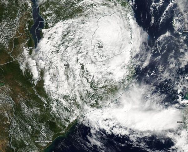
On April 25, NASA’s Aqua satellite passed over Mozambique. The Moderate Resolution Imaging Spectroradiometer or MODIS instrument captured a visible image of the remnants of Tropical Cyclone Kenneth as it continued to linger over the country and generate rainfall. According to the Republic of Mozambique’s National Meteorological Institute (NMI), on April 25, “Kenneth was nestled in the valley of Cabo Delgado, located in the District of Macomia.”
According to the Joint Typhoon Warning Center, Kenneth made landfall with maximum wind speeds of 140 miles per hour (220 kph), the equivalent of a Category 4 hurricane.
Read more at NASA/Goddard Space Flight Center
Image: On April 25, NASA's Aqua satellite passed over Mozambique and captured a visible image of the remnants of Tropical Cyclone Kenneth as it continued to linger over the country and generate rainfall. (Credit: NASA Worldview, Earth Observing System Data and Information System (EOSDIS))


