
Visible imagery from NASA’s Aqua satellite showed Tropical Cyclone Fani appeared more organized than the previous day.
Visible imagery from NASA’s Aqua satellite showed Tropical Cyclone Fani appeared more organized than the previous day.
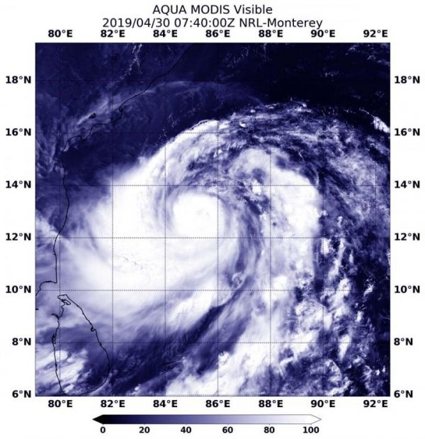
On April 30, at 3:40 a.m. EDT (0740 UTC) the Moderate Resolution Imaging Spectroradiometer or MODIS instrument aboard NASA’s Aqua satellite provided a visible image of Fani. The image revealed a tight circular area of powerful thunderstorms around Fani’s small low-level center of circulation. A large, powerful and thick band of thunderstorms spiraled into the center from the west, and a large fragmented band circled the center from the east. There’s also the hint of a developing eye in the MODIS image.
At 11 a.m. EDT (1500 UTC), the Joint Typhoon Warning Center or JTWC noted that the maximum sustained winds had increased to 90 knots (104 mph/167 kph). That’s the equivalent of a Category 2 hurricane on the Saffir-Simpson Hurricane Wind Scale. Fani was centered near 12.9 degrees north latitude and 85.5 degrees east longitude, approximately 612 nautical miles south-southwest of Calcutta, India. Fani was moving to the northwest.
Read more at NASA/Goddard Space Flight Center
Image: On April 30, at 3:40 a.m. EDT (0740 UTC) the MODIS instrument aboard NASA's Aqua satellite provided a visible image of Tropical Cyclone Fani in the Northern Indian Ocean showing powerful thunderstorms around the center of circulation. (Credit: NASA/NRL)


