
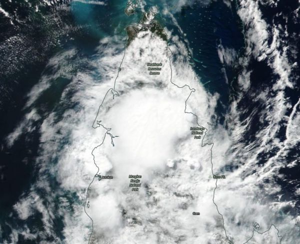
NASA-NOAA’s Suomi NPP satellite passed over the Southern Pacific Ocean and captured a visible image of the remnants of Tropical Cyclone Ann moving over Queensland’s Cape York Peninsula.
NASA-NOAA’s Suomi NPP satellite passed over the Southern Pacific Ocean and captured a visible image of the remnants of Tropical Cyclone Ann moving over Queensland’s Cape York Peninsula. Despite the storm weakening below tropical cyclone status, warnings remain active for strong winds and flooding potential.
The Australian Bureau of Meteorology or ABM issued a Strong Wind Warning for the North East Gulf of Carpentaria for today, May 15, and tomorrow, May 16. There is also a Flood Watch in effect for coastal catchments between Cooktown and Port Douglas.
Ex-Tropical Cyclone Ann has the potential to generate areas of heavy rainfall. ABM noted “Catchments remain wet following coastal showers and rain areas during the last few days, which will make stream rises and flooding more likely with the onset of heavy rainfall. Enhanced rainfall is expected to occur on the coastal catchments north of Port Douglas and through to Cooktown during Wednesday.” Heavy rainfall may also lead to flash flooding and the catchments likely to be affected include the Endeavour River and the Daintree River.
Read more at NASA / Goddard Space Flight Center
Image: NASA-NOAA’s Suomi NPP satellite passed over the Southern Pacific Ocean and captured a visible image of Ex-Tropical Cyclone Ann on May 15, 2019, as it continued to move over the Cape York Peninsula. Credit: NASA Worldview, Earth Observing System Data and Information System (EOSDIS).


