
Subtropical Storm Andrea was gone before the storm could even reach Tropical Storm status.
Subtropical Storm Andrea was gone before the storm could even reach Tropical Storm status. The last advisory for this storm was issued at 5:00pm AST/EDT on May 21, 2019.
Andrea’s formation marks the fifth consecutive year that a named storm has developed before the official start of Atlantic hurricane season on June 1. Andrea went from a subtropical storm to a remnant low in two days. Its location 370 km west southwest of Bermuda meant that no coastal watches or warnings were necessary for this storm. Its maximum sustained winds are 35 mph and the present movement of the low is east northeast at 8 mph.
Read more at NASA / Goddard Space Flight Center
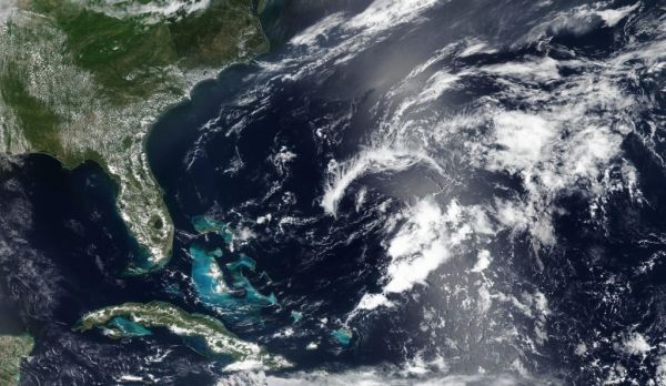
Image: NASA’s Earth Observing System Data and Information System (EOSDIS) Worldview application provides the capability to interactively browse over 700 global, full-resolution satellite imagery layers and then download the underlying data. Many of the available imagery layers are updated within three hours of observation, essentially showing the entire Earth as it looks “right now.” The storm was dissipating when the Suomi NPP satellite captured this image on May 21, 2019. CREDIT: NASA Worldview, Earth Observing System Data and Information System (EOSDIS).


