
System 91L is an area of tropical low pressure located in the Bay of Campeche. On June 3, when NASA-NOAA’s Suomi NPP satellite passed the western Gulf of Mexico, it captured an image of the storm that showed its extensive reach.
System 91L is an area of tropical low pressure located in the Bay of Campeche. On June 3, when NASA-NOAA’s Suomi NPP satellite passed the western Gulf of Mexico, it captured an image of the storm that showed its extensive reach.
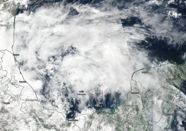
The Visible Infrared Imaging Radiometer Suite (VIIRS) instrument aboard Suomi NPP provided a visible image of the storm. The VIIRS image showed fragmented bands of thunderstorms around System 91L’s circulation center which filled the Bay of Campeche and stretched north into the western Gulf of Mexico. System 91L’s clouds extend from Mexico’s Yucatan state to the west bordering and including the states of Campeche, Tabasco, Veracruz and as far north as Tamaulipas.
At 8 a.m. EDT on June 4, NOAA’s National Hurricane Center or NHC noted that System 91L now has a 40 percent chance to form into a depression over the next two days. “Shower and thunderstorm activity associated with a broad area of low pressure located over the southwestern Gulf of Mexico has decreased since yesterday and remains disorganized. This system could briefly become a tropical depression before moving inland over northeastern Mexico later today or tonight. “
Rread more: NASA
NASA-NOAA's Suomi NPP satellite passed over the Gulf of Mexico and captured a visible image of developing low pressure System 91L on June 3, 2019. Clouds associated with the system filed the Bay of Campeche and stretched north into the western Gulf of Mexico. (Credit: NASA Worldview, Earth Observing System Data and Information System - EOSDIS)


