
Visible imagery from NASA’s Terra satellite provided confirmation of the development of Tropical Cyclone 02A in the Arabian Sea, Northern Indian Ocean.
Visible imagery from NASA’s Terra satellite provided confirmation of the development of Tropical Cyclone 02A in the Arabian Sea, Northern Indian Ocean.
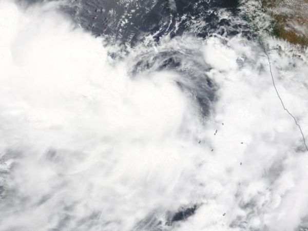
On June 10, the Moderate Resolution Imaging Spectroradiometer or MODIS instrument aboard NASA’s Terra satellite provided a visible image of 02A that showed thunderstorms circling the low-level center. MODIS imagery also showed some clouds and thunderstorms were offset to the northwest of the center. That’s a result of outside winds or vertical wind shear, blowing from the southeast and pushing some clouds to the northwest.
Satellite imagery revealed that the sea surface temperatures are warm enough to support further development of Tropical Cyclone 02A, and forecasters at the Joint Typhoon Warning Center expect some strengthening over the next couple of days.
At 11 a.m. EDT (1500 UTC) on Monday, June 10, 2019, Tropical Cyclone 02A was centered near 13.7 degrees north latitude and 70.8 east longitude. That puts the center about 350 nautical miles south-southwest of Mumbai, India. 02A was moving to the north-northwest at 8 knots (9 mph/15 kph). Maximum sustained winds were near 45 knots (52 mph/83 kph).
Read more at: NASA
On June 10, 2019, the MODIS instrument aboard NASA's Terra satellite provided a visible image of Tropical Cyclone 02A in the Northern Indian Ocean, off the western coast of India. (Credit: NASA Worldview, Earth Observing System Data and Information System)


