
The Global Precipitation Measurement mission or GPM core satellite passed over the storm and measured the rate in which rain was falling throughout it.
The Global Precipitation Measurement mission or GPM core satellite passed over the storm and measured the rate in which rain was falling throughout it.
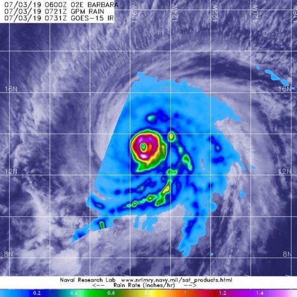
The GPM core satellite passed over Hurricane Barbara at 3:21 a.m. EDT (0721 UTC) on July 3, 2019. GPM found the heaviest rainfall rates were occurring around the eye. There, rain was falling at a rate of more than 50 mm (2 inches) per hour. GPM is a joint mission between NASA and the Japan Aerospace Exploration Agency, JAXA.
NOAA’s National Hurricane Center noted at 4 a.m. EDT (0900 UTC), the eye of Hurricane Barbara was located near latitude 13.5 degrees North and longitude 125.6 degrees West. Barbara is moving toward the west-northwest near 14 mph (22 kph).
Read more at NASA / Goddard Space Flight Center
Image: The GPM core satellite passed over Hurricane Barbara at 3:21 a.m. EDT (0721 UTC) on July 3, 2019. GPM found the heaviest rainfall rate (pink) was northeast of the center of circulation. There, rain was falling at a rate of more than 50 mm (2 inches) per hour. The GPM image was overlaid on a GOES-West infrared image of Barbara’s clouds. CREDIT: NASA/JAXA/NRL/NOAA


