
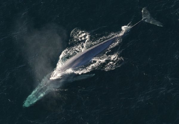
A new model based on daily oceanographic data and the movements of tagged whales has opened the potential for stakeholders to see where in the ocean endangered blue whales are most likely to be so that ships can avoid hitting them.
A new model based on daily oceanographic data and the movements of tagged whales has opened the potential for stakeholders to see where in the ocean endangered blue whales are most likely to be so that ships can avoid hitting them.
The research was published in Diversity and Distributions by Dr. Briana Abrahms, research ecologist at NOAA Fisheries’ Southwest Fisheries Science Center, and related the movements of more than 100 tagged blue whales to daily oceanographic conditions. Abrahms found that ocean conditions affected the whales’ travels in very predictable ways.
Abrahms and her colleagues are now developing an app that will allow managers and ship crews to predict the location of blue whales as they transit along the West Coast. The app will also be accessible to the public and to managers making recommendation on vessel slow-downs or the use of alternative shipping lanes.
“The more we learn about how the physical ocean affects whales and other marine life, the better we are able to predict where those species will be,” Abrahms said. “The goal is to put this technology into the hands of managers, the shipping industry and other users who can most use it to help protect these animals from ship strikes and other human threats.”
Read more at: NOAA Fisheries
Photo Credit: janeb13 via Pixabay


