
A massive complex of thunderstorms over the southeastern United States slid into the northeastern Gulf of Mexico and now has the potential to develop into a tropical cyclone.
A massive complex of thunderstorms over the southeastern United States slid into the northeastern Gulf of Mexico and now has the potential to develop into a tropical cyclone. NOAA’s National Hurricane Center or NHC in Miami, Florida issued the first advisory of Potential Tropical Cyclone Two and NOAA’s GOES-East satellite and NASA’s GPM satellite provided views of the storm.
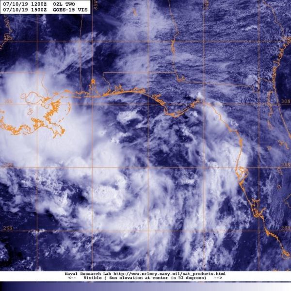
On July 10 at 11 a.m. EDT (1500 UTC), NOAA’s GOES-East satellite provided a visible image of the developing storm. The NHC said, “High-resolution satellite imagery along with surface and upper-air data indicate that the broad low pressure system located over the northeastern Gulf of Mexico has become a little better defined.”
The Global Precipitation Measurement mission or GPM core satellite passed over the developing area of low pressure early on July 10 and found rain was falling at a rate of more than 50 mm (about 2 inches) per hour. Forecasters at the NHC said that the system has the potential to produce very heavy rainfall along and inland of the central Gulf Coast through early next week. GPM is a joint mission between NASA and the Japan Aerospace Exploration Agency, JAXA.
Read more at NASA / Goddard Space Flight Center
Image: On July 10, 2019 at 11 a.m. EDT (1500 UTC) NOAA’s GOES-East satellite provided a visible image of Potential Tropical Cyclone Two as it continued to develop in the northeastern Gulf of Mexico. Credit: NOAA/NRL


