
NASA’s Aqua satellite found Tropical Storm Danas moving over Japan’s Ryuku island chain in the Northwestern Pacific Ocean.
NASA’s Aqua satellite found Tropical Storm Danas moving over Japan’s Ryuku island chain in the Northwestern Pacific Ocean.
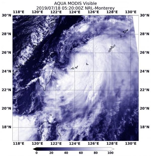
The Ruyku islands include Osumi, Tokara, Amami, Okinawa, Yonaguni and the Sakishima Islands. The island chain extends southwest from Kyushu to Taiwan.
On July 18 at 1:20 a.m. EDT (0520 UTC), the Moderate Resolution Imaging Spectroradiometer or MODIS instrument aboard NASA’s Aqua satellite provided a visible image of Danas that showed a large storm over Japan’s Ryuku Island chain. The image shows that Danas is being affected by vertical wind shear, where winds at different levels of the atmosphere around the tropical cyclone are pushing against it and affecting the storm’s shape. The Joint Typhoon Warning Center noted, “A large area of deep convection sheared 60 nautical miles southward of a consolidating low-level center.
Read more at NASA/Goddard Space Flight Center
Image: On July 16, 2019, the MODIS instrument aboard NASA's Aqua satellite provided a visible image of Tropical Depression Danas in the Northwestern Pacific Ocean. (Credit: NASA Worldview, Earth Observing System Data and Information System (EOSDIS))


